
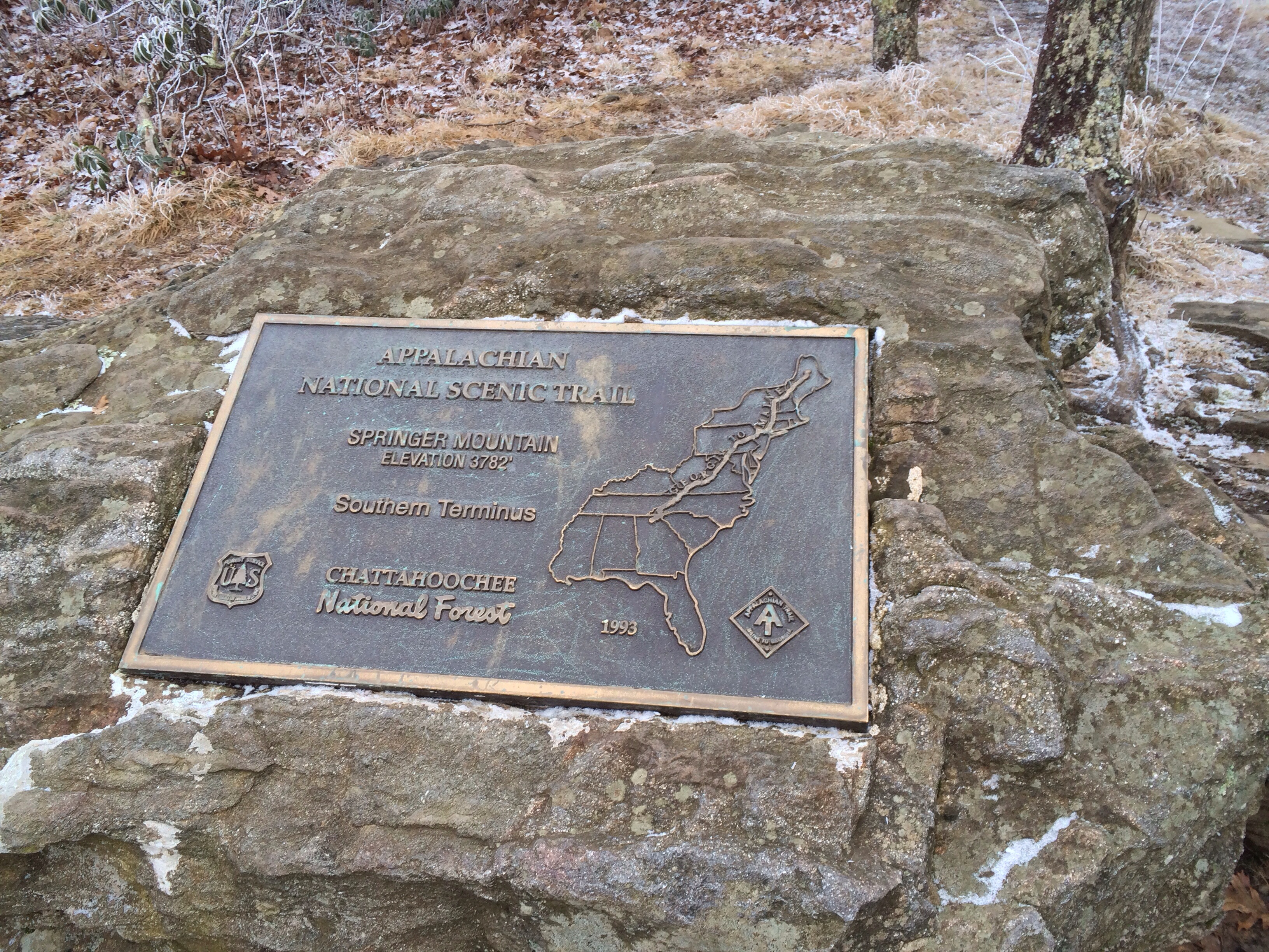
Measuring life in metrics, getting to the top of Springer Mountain was 8.3 miles from starting at Amicalola Falls State Park for travelers unfamiliar with the journeying to the Appalachian Trail; however, I had traveled so much further beyond maps or miles. I had carved out a mental image from films, a friend’s listing of favorite books, and a mutual wanderlust. The objective of the day was reaching the southern terminus, aka tip, of the Appalachian Trail (AT) on this mountain top.
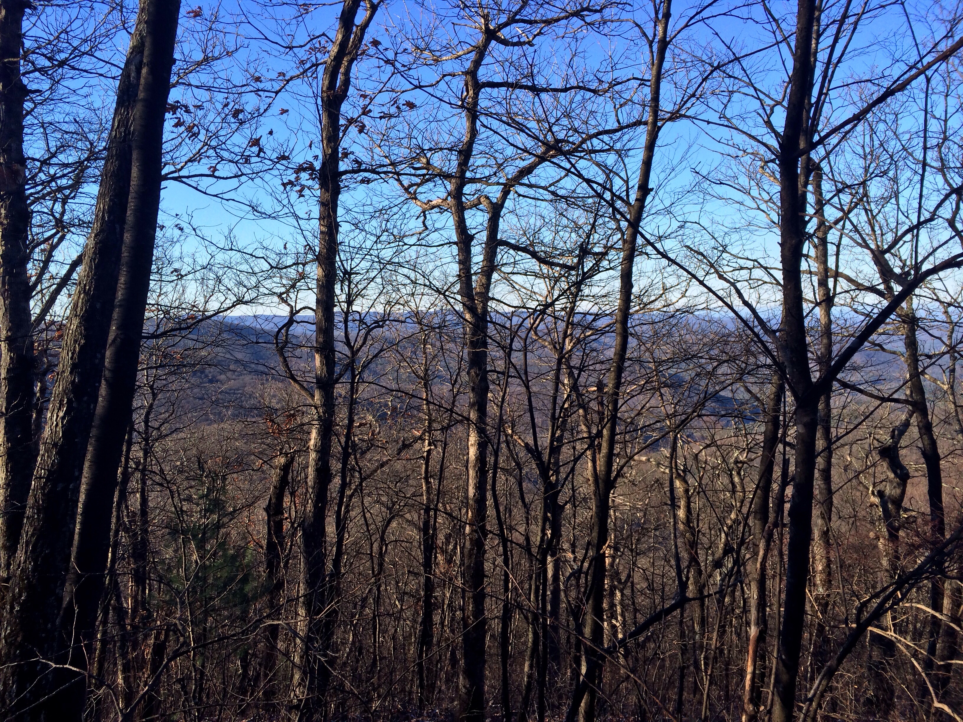
At the start of this Sunday, the view atop Amicolola Falls had gave way to the Blue Ridge mountain range below a clear baby blue sky. The mind’s eye aside, climbing Amicalola Falls’ steps a second day in a row had become a welcome break from hiking in the cold damp darkness of the night before. After soaking in this gaze for a few moments, we had quickly retraced about two miles of progress from the previous evening. We had reflected on the decision to turn back momentarily being the “right choice” and “smart choice.” With that in mind, the next revelation of the day had come in the discovery of a clearing for an open air camping area. It was just past the previous night’s turnaround point. Any second guessing our decision had quickly washed away with daylight illuminating a clear sight of stout mountains and leaf less trees. The day’s hike had continued from there in a rhythmic manner; ”up”, “then down,” “up,” and “up again.”
During our first major mountain ascent, this pattern was interrupted by a descending party of about ten people. Out of common courtesy and easy passage, we had pulled to the side of the trail. While eating a snack of pop tarts, a little blonde girl stepping down the path had wished us a Merry Christmas. This innocent act had colored our physical activity in a different range of emotions. A common bond of community had asserted itself beyond our solitary activity. Before starting up again, an elderly gentlemen had asked about the trail below. In his response, my travel companion had described the steep decline and his preference for stark inclines instead. The gentleman’s response was, “You’re going to get plenty of that shortly.” So we had begun our hiking rhythm again. Until late afternoon, we had marched taking impromptu breaks for water, food, bathroom, and of course photographic evidence!
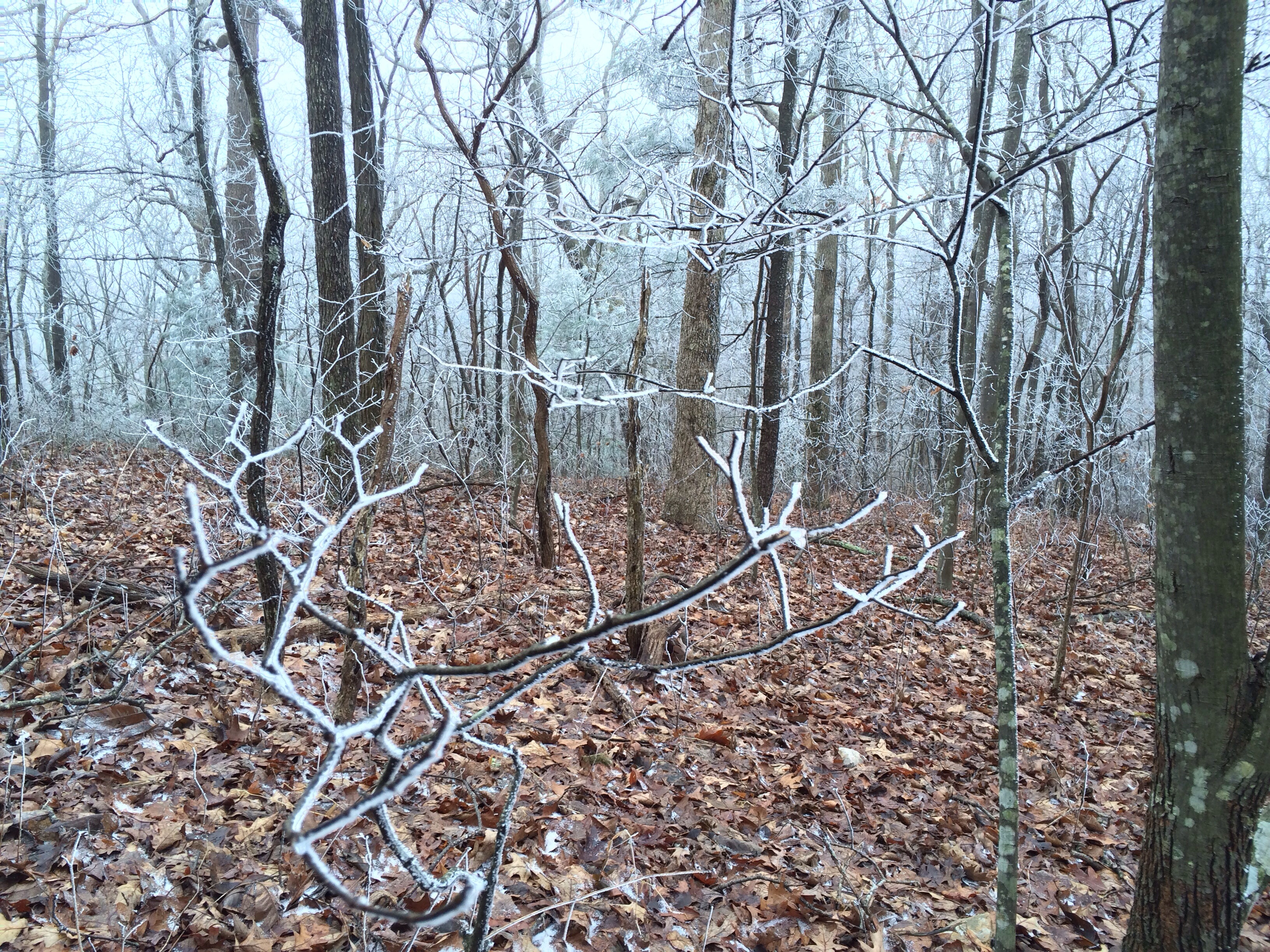
Approaching the final three miles of our trek, we had started to experience cold gusts and snow flurries. At first, I had thought the snow some form of fungus or tree decay. Not seeing snowflakes since the age of 18, it had provided a degree of personal wonderment and euphoria. In contrast, the brooding grey clouds had sparked some personal concerns. Having lived in tropical zones most of my life from Florida, the Bahamas and Singapore, I had wanted to limit my exposure to the elements with the onset of dusk. The elevation and chill were one set of tenable question marks. I had thought, “What of water in its various forms; sleet, rain, snow?” Water had offered the greatest potential for transforming this rocky landscape into something seductively dangerous. Regardless of the answer, I had not wanted to find out in the dark of night.
Fortunately, we were close to reaching one of two trail shelters and our final destination. The first landmark denoting our proximity to this first shelter was a wooden blue sign pointing down to water. Navigating down the slope to a tiny creek, my friend had graciously volunteered for water extraction duty. At the creek, he had used a manual filter pump for collecting water. While waiting for his return, my mind had drifted into mischief. Up to this point, I was channeling a certain degree of seriousness, unwieldy for such an adventure. The idea of mooning him from a downed log had popped in my brain; however, the biting cold wind gusts had wiped that idea clear into oblivion.
With my buddy topside, we had walked about another half mile to signs pointing to the first wooden shelter. Scouting out the shelter for a few minutes, another pair of hikers had converged on our location. We had exchanged information relating to portions of the trail. After deciding to press forward, my friend had leveraged this opportunity for maxing out our water supply near this shelter. With the three of us remaining, we had stopped any physical activity while chatting. The immediate impact, we had all begun getting painfully cold in our hands and feet. During my wait, I had started moving about in circle compensating for walking on the trail. With my friend’s return, we had headed out on the last two miles of journey.
After picking up our walking tempo, we had arrived in short order at the demarcation for the southern terminus of the AT. In this clearing, two metal plaques had adorned rock along with a log book and statue. The only disappointment were the clouds obstructing the mountain top overlook. After breaking from photo ops, we had pushed on to the final destination for the day, a mountain top shelter. At this multi-level wooden shelter, we had encountered several other travelers. They had placed a tarp over the front opening to reduce the wind gusts. They had also attempted building a fire; however, the cold wet wood had kept the fire from being viable. As far as sleeping for the night, the other travelers had conceded the elevated loft area for my friend and me. After eating some food, we had prepped our sleeping bags and clothes for slumber. During the night, I had focused on trying to keep my fingers and toes warm. I was bit paranoid with the rating on my Coleman sleeping bag. Before sundown, the temperature was around 30 degree F. What I hadn’t known, according to someone else’s gauge, the temperature dipping into the 20s.
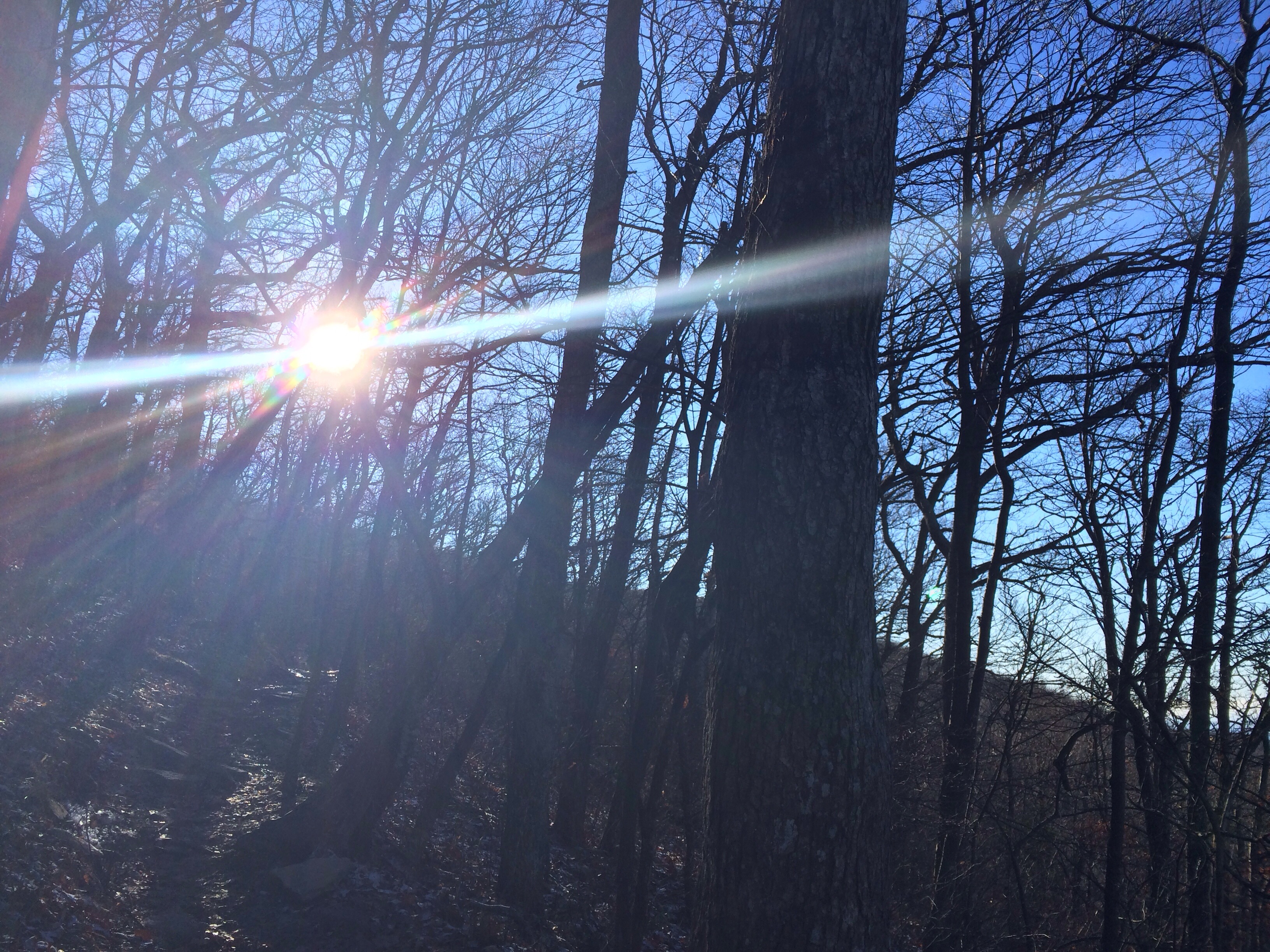
Eventually, daylight had returned to the mountain top with warmer temperatures. Also returning, was our desire to move on from Springer Mountain. Our next destination, Hawk Mountain, was already brewing an image in our mind’s eye. Measuring life in moments, this was a start to another great day of wanderlust on the AT.
Read More:
Springer Mountain (Wikipedia)
Springer Mountain (GeorgiaTrails.com)
Review: Appalachian Impressions (GarzaFX)
Review: National Geographics’s America’s Wild Spaces: Appalachian Trail (2009) (GarzaFX)


Sponsored by Seminole Scuba

Get to know Paul Shepherd and his competent team at Seminole Scuba in Lake Mary, Florida, whether getting certified or making a once in a lifetime trip like AFRICA 2014.
More Information:
website: www.seminolescuba.com
phone: 407-333-8856
